A map of Balham provides a clear view of one of South West London’s most connected neighbourhoods, showing its main streets, transport links, nearby areas, green spaces, and important landmarks. Located in the London Borough of Wandsworth, Balham is centred around Balham High Road and Balham Station, with the SW12 postcode area covering much of the neighbourhood. Its position between Clapham, Tooting, Wandsworth, and Streatham Hill makes it an important connection point in South London.
Whether you are visiting Balham, moving to the area, or trying to understand its layout, a detailed map makes navigation much easier. The neighbourhood combines busy commercial streets with peaceful residential roads, Victorian housing areas, local markets, and large open spaces such as Tooting Bec Common and Wandsworth Common. Understanding the map of Balham helps reveal how each part of the area connects and why it has become a popular location for residents and visitors.
Where Is Balham Located on the London Map?
Balham is located in South West London within the London Borough of Wandsworth and sits inside the SW12 postcode district. On a London map, Balham is positioned south of Clapham, north of Tooting, east of Wandsworth Common, and close to Streatham Hill. This central location gives Balham easy access to several well-known South London neighbourhoods while keeping its own strong community identity.
The easiest way to identify Balham on a map is to locate Balham High Road, which runs through the centre of the area, and Balham Station, which acts as the main transport point. From this central location, visitors can reach shops, restaurants, parks, and residential streets within a short walking distance. The area’s layout is a mixture of busy main roads and quieter side streets, creating a balance between convenience and suburban living.
Understanding the Main Streets on the Map of Balham
The street layout of Balham is built around several important roads that shape how people move through the neighbourhood. Balham High Road is the main route and acts as the commercial heart of the area, featuring independent shops, cafés, restaurants, supermarkets, and local services. Anyone exploring Balham for the first time will usually begin here because many important locations are nearby.
Bedford Hill, Nightingale Lane, Chestnut Grove, and Ritherdon Road are also important streets shown on a detailed Balham map. Bedford Hill connects the central area with residential zones and is known for entertainment venues and restaurants. Nightingale Lane leads towards quieter residential areas, while roads around Ritherdon Road highlight Balham’s Victorian and Edwardian housing character.
Balham High Road and Central Area Map Guide
Balham High Road is the main landmark when understanding the map of Balham. It stretches through the centre of the neighbourhood and connects different parts of South London. The road contains many of the area’s busiest locations, including restaurants, cafés, shops, and community facilities. For visitors, using Balham High Road as a reference point makes it easier to explore surrounding streets.
Near the centre of Balham, you will find Balham Underground Station, Balham railway station, Hildreth Street Market, and several popular local businesses. The area around the station is the most active part of the neighbourhood, while streets further away become quieter and more residential. This transition from busy centre to peaceful streets is one of the defining features visible on a Balham area map.
Balham Neighbourhood Boundaries and Nearby Areas
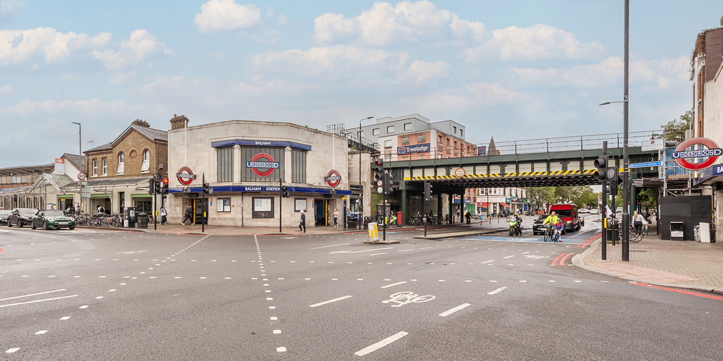
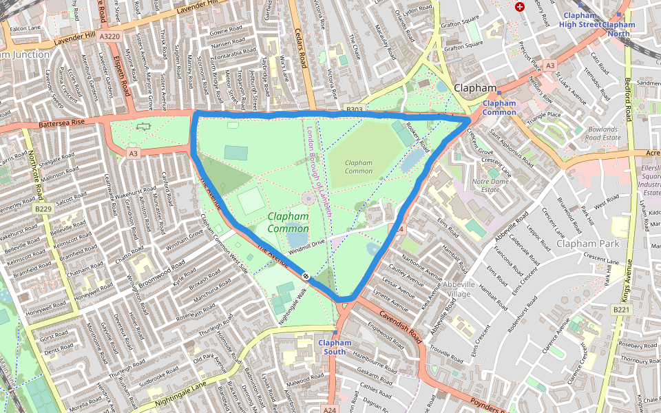
A complete map of Balham also shows how the neighbourhood connects with surrounding areas. To the north, Clapham South provides links towards Clapham and central parts of London. To the south, Tooting offers additional shopping areas, restaurants, and cultural attractions. Wandsworth Common lies to the west, providing access to one of the area’s most attractive green spaces.
The relationship between these nearby districts helps explain Balham’s popularity. Residents can enjoy the facilities of several neighbourhoods while still benefiting from Balham’s own high street, transport network, and community atmosphere. Looking at Balham on a wider South London map shows that it is not isolated but part of a connected network of neighbourhoods.
Transport Map of Balham: Tube, Rail and Bus Connections
Transport is one of the most important features shown on any map of Balham. Balham Underground Station is located on the Northern Line, providing direct connections towards central London destinations including Bank, London Bridge, and Leicester Square. This makes Balham a convenient choice for commuters who need reliable access to the city.
Balham railway station provides additional travel options through National Rail services, including connections towards Clapham Junction and London Victoria. The combination of Underground and rail services gives Balham an advantage over many other South London areas. Bus routes also connect Balham with nearby districts, making local travel easier for residents and visitors.
Walking Routes and Distances Around Balham
A walking map of Balham shows that many important locations are close together. Balham Station is positioned near the centre of local activity, with Balham High Road, restaurants, cafés, and shops all within easy walking distance. This makes the neighbourhood simple to explore without relying on a car or public transport for short journeys.
Popular walking routes include journeys from Balham Station towards Hildreth Street Market, Bedford Hill, and nearby residential streets. Tooting Bec Common can also be reached on foot, making it a popular destination for walking, exercise, and outdoor activities. The pedestrian-friendly layout is one reason Balham feels more like a village centre despite being part of Greater London.
Parks and Green Spaces on the Balham Map
Green spaces play an important role in Balham’s geography. When viewing a map of Balham, two major open areas stand out: Tooting Bec Common and Wandsworth Common. These parks provide large outdoor spaces where residents can enjoy walking, sports, relaxation, and family activities.
Tooting Bec Common is particularly well known because it contains Tooting Bec Lido, one of the largest outdoor swimming pools in the UK. Wandsworth Common offers another peaceful environment with ponds, walking paths, and open fields. Their location around Balham adds significant value to the neighbourhood by providing natural spaces close to urban facilities.
Important Landmarks and Attractions on the Map of Balham
Several landmarks help visitors understand the layout of Balham. The Bedford is one of the area’s most recognisable venues, located on Bedford Hill and known for its connection with live entertainment, comedy, and music. Hildreth Street Market is another important point, offering independent businesses, cafés, and local food options.
Other useful landmarks include Balham Library, Balham Station, local restaurants, and community facilities. These places act as reference points when navigating the neighbourhood. A good map of Balham connects these landmarks together, helping visitors plan routes and understand where different parts of the area are located.
Living in Balham: Residential Areas Explained
A residential map of Balham shows a variety of housing areas, from Victorian terraces and Edwardian homes to modern apartments near transport connections. Streets closer to Balham Station are popular among commuters because they provide quick access to central London, while quieter areas around Nightingale Lane and surrounding roads attract families and people looking for a more peaceful environment.
Balham is popular because it combines practical facilities with a strong local community. Residents have access to schools, healthcare services, shops, restaurants, and green spaces. Understanding the different residential zones on a map can help people choose the part of Balham that best matches their lifestyle and daily needs.
Historical Development of Balham’s Streets and Map Layout
Balham’s current map reflects centuries of development. Originally a rural settlement, the area changed significantly during the nineteenth century as London expanded and railway connections improved. The arrival of transport links helped transform Balham from a village-like area into a connected suburban neighbourhood.
Many streets still show the influence of Victorian expansion, with traditional housing layouts and historic buildings remaining part of the modern landscape. Comparing older maps of Balham with today’s streets reveals how the area has grown while maintaining many elements of its original character.
Why the Map of Balham Is Useful for Visitors and Residents
A detailed map of Balham is useful because it combines practical navigation with an understanding of the area’s character. Visitors can use it to find attractions, restaurants, parks, and transport links, while residents can better understand connections between different neighbourhood sections.
Balham’s layout makes it easy to move between busy commercial areas and quieter residential streets. Whether you are planning a short visit, commuting daily, or considering moving to South London, understanding the map of Balham provides a clearer picture of how the neighbourhood works.
Conclusion
The map of Balham shows much more than streets and locations; it reveals how this South London neighbourhood connects people, transport, green spaces, and local attractions. From Balham High Road and Underground connections to residential streets and nearby commons, every part of the area contributes to its unique identity.
Balham’s combination of accessibility, community facilities, historic streets, and natural spaces makes it one of the most interesting neighbourhoods in South West London. Whether you are exploring the area for the first time or planning a future move, understanding its map helps you discover how each part of Balham connects.
FAQs
Where is Balham located on the London map?
Balham is located in South West London within the London Borough of Wandsworth and the SW12 postcode area.
What is the main road in Balham?
Balham High Road is the main road running through the centre of the neighbourhood.
Which Tube line serves Balham?
Balham Underground Station is served by the Northern Line.
What areas are close to Balham?
Clapham South, Tooting, Wandsworth, Streatham Hill, and Wandsworth Common are close to Balham.
Is Balham a good area to live in?
Yes, Balham is popular because of its transport links, green spaces, local amenities, and community atmosphere.
You May Also Read: New iPhone Battery Cost UK