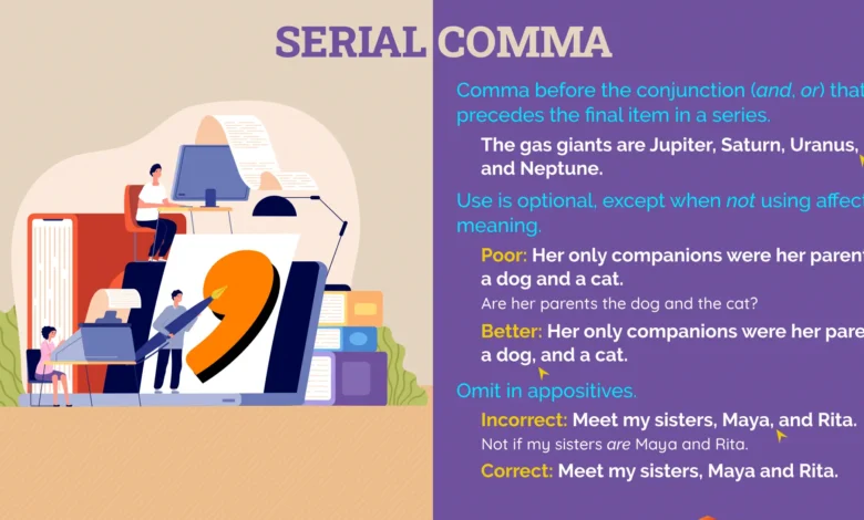
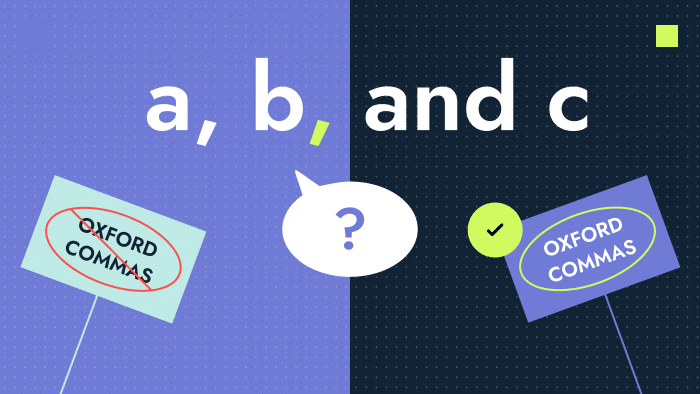
The Oxford comma is one of the most debated punctuation marks in the English language. Also known as the serial comma, it appears before the final conjunction in a list of three or more items. While it may seem like a small grammatical detail, the Oxford comma has sparked discussions among writers, editors, journalists, teachers, and language enthusiasts for decades. Some believe it is essential for clarity and precision, while others view it as unnecessary punctuation that can be omitted without affecting meaning.
Consider the sentence: “I would like to thank my parents, Oprah Winfrey and Taylor Swift.” Without an Oxford comma, the sentence suggests that Oprah Winfrey and Taylor Swift are the writer’s parents. Adding the Oxford comma changes the meaning entirely: “I would like to thank my parents, Oprah Winfrey, and Taylor Swift.” This simple example demonstrates how one small punctuation mark can prevent confusion and improve readability.
The debate surrounding the Oxford’comma continues because different style guides offer different recommendations. Academic institutions often encourage its use, while many journalism organizations prefer to omit it except when necessary for clarity. As a result, writers frequently encounter conflicting advice regarding whether they should include it in their work.
This comprehensive guide explores the history, purpose, usage, advantages, disadvantages, and modern relevance of the Oxford comma. Whether you are a student, blogger, business professional, or aspiring author, understanding this punctuation rule can help improve the quality and clarity of your writing.
What Is the Oxford Comma?
The Oxford comma is the comma placed immediately before the conjunction—usually “and” or “or”—in a list of three or more items. For example, in the sentence “We bought apples, oranges, and bananas,” the comma before “and” is the Oxford comma. Without it, the sentence would read “We bought apples, oranges and bananas.” Both versions are grammatically acceptable depending on the style guide being followed.
The term “Oxford comma” originates from its association with Oxford University Press, which traditionally recommended its use in published works. Over time, the punctuation mark became widely recognized and adopted by many academic and professional writers. Because of its connection to formal writing standards, many educators teach students to use it consistently.
The primary purpose of the Oxford’comma is to improve clarity. Lists can sometimes create ambiguity, especially when individual items contain additional information or compound elements. By inserting the final comma, writers can make relationships between listed items easier for readers to understand.
Although the Oxford comma appears simple, its impact on communication can be significant. It serves as an example of how punctuation shapes meaning and influences interpretation. Understanding when and why it is used is the first step toward mastering effective written communication.
The History of the Oxford Comma
The history of the Oxford comma stretches back centuries and reflects the evolution of English punctuation. Early English writing lacked the standardized punctuation systems that exist today. Writers often used commas, semicolons, and other marks inconsistently, relying on personal preference rather than formal rules. As publishing expanded and literacy rates increased, the need for standardized grammar became more apparent.
By the nineteenth century, publishers and editors began developing style guides to create consistency across books, newspapers, and academic works. Oxford University Press emerged as one of the leading institutions promoting the use of the serial comma. Their editorial standards emphasized clarity and precision, values that aligned with the purpose of the Oxford’comma.
As journalism developed, however, some newspapers sought ways to reduce space and simplify formatting. Omitting the final comma in lists became a common practice in newspaper publishing. Organizations such as the Associated Press adopted style guidelines that generally avoided the Oxford comma unless it was necessary to prevent confusion.
Today, the Oxford comma remains at the center of a stylistic debate rather than a grammatical one. Most experts agree that either approach can be correct if used consistently. The continuing discussion demonstrates how language evolves and adapts to different forms of communication.
How the Oxford Comma Works
The Oxford comma functions within lists and series. Its placement is straightforward: when three or more items are listed, a comma appears before the final conjunction. For example, “The conference featured speakers from Canada, Germany, and Australia.” The comma before “and” is the Oxford’comma.
In everyday writing, the Oxford comma can enhance readability by clearly separating list items. This becomes especially important when listed elements contain their own conjunctions or descriptive phrases. Without proper punctuation, readers may struggle to determine where one item ends and another begins.
Business communication often benefits from Oxford comma usage. Reports, proposals, and professional emails frequently contain detailed lists that require clarity. Ambiguous wording can lead to misunderstandings, making punctuation an important tool for effective communication.
Academic writing also favors the Oxford comma because scholarly work demands precision. Researchers, students, and professors often follow style guides such as APA and Chicago, both of which generally recommend using the serial comma. Consistent punctuation helps maintain professionalism and reduces the possibility of misinterpretation.
Examples of the Oxford Comma in Action
One of the best ways to understand the Oxford comma is through examples. Consider the sentence: “The award was presented to the principal, the teachers and the students.” While understandable, some readers may briefly pause to interpret the relationship between the listed groups. Adding the Oxford comma—“The award was presented to the principal, the teachers, and the students”—creates a clearer separation.
Another example demonstrates how punctuation can dramatically change meaning. The sentence “I dedicate this book to my parents, Nelson Mandela and Queen Elizabeth” implies that Nelson Mandela and Queen Elizabeth are the writer’s parents. Including the Oxford comma eliminates that confusion: “I dedicate this book to my parents, Nelson Mandela, and Queen Elizabeth.”
Legal cases have even highlighted the importance of the Oxford’comma. In some situations, contractual language lacking a serial comma has resulted in disputes regarding interpretation. Courts have occasionally examined punctuation when determining the meaning of legal documents, illustrating the real-world consequences of grammatical choices.
These examples reveal why many writers support the Oxford comma. Even when ambiguity seems unlikely, the additional punctuation provides a safeguard against potential misunderstandings.
Why Writers Disagree About the Oxford Comma
Supporters of the Oxford comma argue that it improves clarity, consistency, and professionalism. They believe that including the final comma creates a standardized approach to list construction and minimizes ambiguity. Many editors and educators prefer this method because it provides a straightforward rule that can be applied consistently.
Opponents, however, view the Oxford’comma as unnecessary in many situations. They argue that context usually provides sufficient clarity and that adding extra punctuation can clutter sentences. Journalists, in particular, often favor brevity and efficiency, which explains why AP Style generally omits the serial comma.
The disagreement is not about grammatical correctness but rather stylistic preference. Both approaches have valid arguments and are accepted within different professional environments. The most important factor is consistency. Switching between styles within the same document can create confusion and undermine credibility.
Ultimately, the choice depends on audience expectations, organizational guidelines, and personal preference. Writers should understand both perspectives and adapt their usage accordingly.
Oxford Comma in Modern Writing
In today’s digital world, the Oxford’comma remains highly relevant. Blogs, websites, marketing content, and social media posts all rely on clear communication. Readers often consume information quickly, making readability more important than ever. Proper punctuation helps ensure that messages are understood accurately.
Content creators and SEO writers frequently use the Oxford’comma because it contributes to smoother reading experiences. While search engines do not directly rank content based on punctuation, user engagement can benefit from well-structured writing. Clear sentences encourage readers to stay on a page longer and interact with content more effectively.
Businesses also recognize the value of precise communication. Contracts, policies, reports, and presentations often require language that leaves little room for interpretation. The Oxford’comma can help achieve that goal by clarifying relationships between listed items.
As communication continues evolving across digital platforms, the Oxford comma remains a useful tool for writers seeking accuracy and professionalism. Its enduring presence demonstrates that even the smallest punctuation marks can have a significant impact.
Conclusion
The Oxford comma may be small, but its influence on written communication is substantial. By appearing before the final conjunction in a list, it helps clarify meaning, improve readability, and prevent ambiguity. Although style guides differ in their recommendations, the Oxford’comma remains one of the most discussed punctuation rules in the English language.
Whether you choose to use it or omit it, consistency is essential. Writers who understand the purpose and function of the Oxford comma can make informed decisions based on their audience, industry standards, and communication goals. In a world where clarity matters, this tiny punctuation mark continues to play an important role.
FAQs
What is an Oxford comma?
The Oxford comma is the comma placed before the final conjunction in a list of three or more items.
Why is it called the Oxford comma?
It is named after Oxford University Press, which traditionally promoted its use.
Is the Oxford comma grammatically correct?
Yes. It is widely accepted and recommended by many style guides.
Does AP Style use the Oxford comma?
Generally, AP Style omits it unless it is necessary for clarity.
Why do some writers prefer the Oxford comma?
Because it improves clarity and reduces ambiguity.
Can omitting the Oxford comma cause confusion?
Yes. In some cases, the meaning of a sentence can change significantly.
Is the Oxford comma required in academic writing?
Many academic style guides, including APA and Chicago, recommend using it.
What is another name for the Oxford comma?
It is also known as the serial comma.
Should businesses use the Oxford comma?
Many businesses prefer it because it promotes clear and professional communication.
Can one comma really change a sentence’s meaning?
Absolutely. Numerous examples demonstrate how punctuation can alter interpretation and create confusion.
You May Also Read: Oxford Weather